Using a drone to determine extraction quantities
Students embark on project at Klasmann-Deilmann
Whenever possible, Klasmann-Deilmann gives assignments with a difference to young people doing vocational training and study programmes. These include a current project on drones involving five students. They are using the latest information technology to develop a method that delivers extremely precise quantitative assessments of stocks in extraction areas.
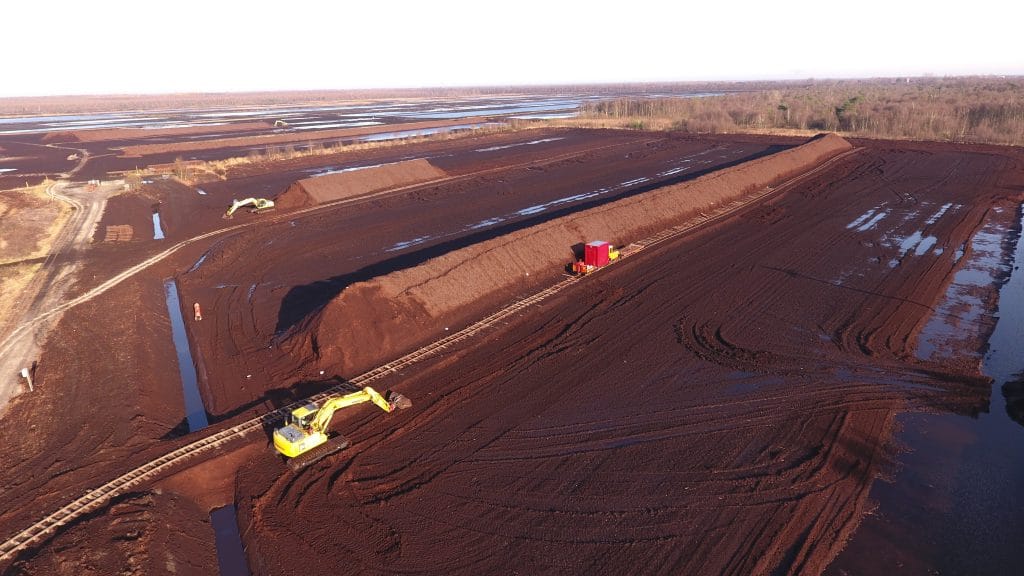
Weather conditions are favourable. It’s sunny with almost no wind. Five students have driven out onto one of our extraction sites. Their daring mission: a test flight with a drone. On a level surface within the Ostfeld peatfield, they place the quadrocopter on the ground. Before takeoff, they enter the desired altitude in the control tablet and set the intervals at which the integrated camera is to take photos.
The miniature aircraft, weighing some 1.5 kg, takes off, climbing steadily and reaching an altitude of 80 m. The students watch, transfixed by this technological marvel. Then the quadrocopter starts its forward movement high above the 500-odd-metre-long peat stack.
“It makes five passes over the stack in different positions to take photos with a high degree of overlap,” explains Lars Wortelboer. Two years ago Lars began a combined vocational training und degree programme in Lingen, doing Business Information Systems at Osnabrück University of Applied Sciences (HSO). He is assisting our IT team during his practical-training phases.
These drone flights are part of a study project. As the group consists of prospective IT specialists and business administrators, a topic had to be found at the interface between these two areas. “When Klasmann-Deilmann suggested working with a drone, we leapt on board straight away,” says Niklas Albers. He had already qualified with us as an Industrial Business Administrator and, building on this, is now doing a combined degree and vocational training course in Business Administration. It was not hard for Lars and Niklas to persuade fellow HSO students based at Lingen to sign up for this quadrocopter drone project with Klasmann-Deilmann.
The small flying machine whirrs over our heads as Niklas explains the process. “One problem is telling where the stack ends and the underlying ground surface begins,” he says, pointing to the boundary zone. This is particularly hard to do from an aerial perspective, since both the stack and the surrounding peatland are the same colour. “So we’ve marked the stacks with small pieces of white tarpaulin.” Lars adds: “These are the reference points or control points for the surveying software.”
It was a long process before they could get the drone up in the air. “We had to fill in lots of forms and obtain approval before we could fly it at all,” he says. This included obtaining take-off permission from the regional roads and transport authority (NLSV) and proving they could safely operate an unmanned aerial system (UAS). For this purpose both of them underwent training at a model aircraft club in Surwold. “And, because we’re in a restricted-flight zone, we can fly only at specific times.”
Lars, Niklas and the others are supported by project supervisor Henry Hurink. Processing data obtained by drones is part of his routine daily work involving the taking of site measurements for our climate footprint. So his experience is invaluable to the students.
The task now is to identify the best method of determining the volume of extracted peat as precisely as possible. “We’re still doing a lot of trying out and testing at the moment,” says Niklas. “The higher the drone, the better the overview, but the accuracy may be compromised above a certain height.” When, starting in February, the raw materials are successively loaded onto the railway cars and the true volume can be determined with reference to the number of wagons, the young investigators can compare their figures with the actual quantity.
The stack dimensions had previously been determined manually using a tape measure. However, as the stacks are not completely symmetrical or even, results obtained this way may well be inaccurate. Use of a drone could soon make such imprecision a thing of the past. Come the springtime, the students will know more …
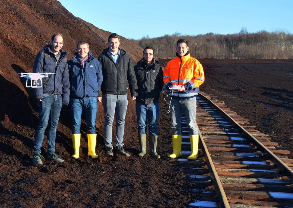
Doing their study project on the use of a drone for stocktaking purposes (from left): Tim Fietzek, Niklas Albers, Marc Scheper, Jonas Smolarek and Lars Wortelboer.